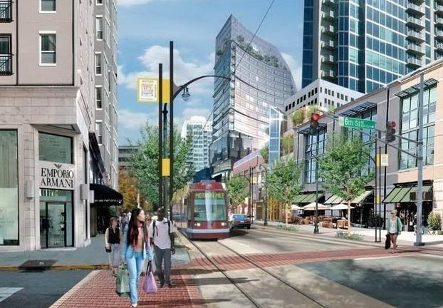
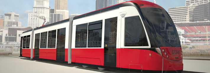
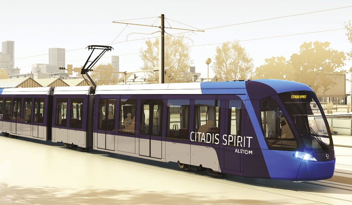
Another simulation view of the CAF streetcar on order for Cincinnati. Graphic: CincyStreetcar blog�.
♦
by John Schneider
An early turning point — there have been many of them — in the long-running effort to build the Cincinnati Streetcar occurred in one of the meetings that evaluated five potential routes. The early consensus favored a straight route on one-way parallel streets anchored by Cincinnati’s convention center, which has been expanded twice in the past thirty years.
Then something remarkable happened. The CEO of Cincinnati’s Convention and Visitors’ Bureau stood up and said, “Look, don’t build this for tourists — they are looking for things to do and they will find the streetcar wherever it is. Let’s build this for Cincinnatians.”
So an alternative quickly rose to the top — a diagonal alignment from southeast to northwest across the basin of downtown Cincinnati that puts just about every major destination within a couple of blocks of the line.
What proved to be key is the connection between employment and housing. While Cincinnati is a small city, it is home to a surprising number of large corporations, including Procter & Gamble, Macy’s, and the Kroger Company. There are seven Fortune 500 companies within a couple blocks of the streetcar line.
Most of these companies, their law and accounting firms and other support services are clustered a few blocks north of the Ohio River. Our region’s bus system is concentrated at the center of this agglomeration, and about 20% of downtown workers commute by bus. The streetcar line would end up flowing through the middle of this too.
At the other end of the line is Over-the-Rhine, so-named by German immigrants who compared the river they knew in their homeland to an early Cincinnati canal bordering OTR. Crossing the canal and going downtown was like “going over the Rhine.” And the name stuck.
Once home to perhaps 35,000 residents, OTR’s population dropped to around 5,000 or so in the 1990’s. Mostly vacant but blessed with beautifull (and mostly intact) Italianate townhouses, the neighborhood had been experiencing a slow comeback for several decades but was losing the battle to the elements and parking lots.
It was an obvious match: downtown workers are the best prospects to repopulate a neighborhood near lots of jobs but not really close enough to be walkable by everyone in all weather and at all times of the day. The streetcar solves that problem.
So the route will traverse the one-way couplet of Main and Walnut in the CBD, cross east/west at its midpoint to travel on another couplet, Elm and Race, which bracket Findlay Market, one of the oldest continuously operating public markets in the country. And perhaps the most authentic and diverse place in all of Cincinnati.
What else is along the Cincinnati Streetcar route? Plenty.
Fountain Square is the symbolic heart of our city and a focus of major investment. When the Reds win the World Series again, thousands of Cincinnatians will gather on the Square to celebrate. No one will require an invitation. It will just happen. The streetcar travels along the edge of the Square.
Speaking of the Reds, the Great American Ball Park is located near Stop #1 for the Cincinnati Streetcar. And Paul Brown Stadium, home of the Bengals, is four blocks away. These facilities are co-located in a huge Ohio River redevelopment project now known as The Banks, a billion dollars of new housing, restaurants, hotel and office space.
For 222 years, Cincinnati didn’t have a flood-proof riverfront, the Ohio River having a nasty habit of fluctuating wildly depending on upstream rainfall. As a result, not much could ever happen there. Now it will, because the parking for the teams — eventually to become one of the largest underground parking garages in North America — provides an invisible, floodable pllatform for the development above. The center of The Banks is about four blocks from Fountain Square with an uphill walk, so the streetcar will help bridge the distance and make commercial and hotel development there more promising.
There are other important destinations along the route of the Cincinnati Streetcar:
• Two-thirds of all the major cultural attractions in the Cincinnati region.
• Two new parks, one on the riverfront, the other in Over-the-Rhine.
• Cincinnati’s main library, now the busiest library building in the United States. There is also a historic private library on the line — one of its founders, a U.S. president.
• A new $72-million-dollar K-12 School for the Creative and Performing Arts, the first of its kind in the nation, which was originally established a half-mile away.
• Several new hotels and more in planning plus three large apartment buildings.
• Many bars and restaurants all along the line and more on the way. Cincinnati is getting to be a foodie town.
While the streetcar is mostly associated with Over-the-Rhine, economists estimate that the greatest real estate gains will occur in the north frame of the CBD. Over-the-Rhine is intimate and charming, and that’s why it is cherished by Cincinnatians. But most of the large parcels of land and buildings suitable for re-use as housing are in the “Empty Quarter” of the CBD between Fountain Square and OTR. Except for the Aronoff Center for the Arts, very little happens there nights and weekends. The streetcar will give this area new life.
City officials plan to extend the streetcar up the hill to Uptown area, to the University of Cincinnati with its 42,000 students and to the several hospitals near it. Downtown Cincinnati is the largest employment center in this 2.1-million-person region. Uptown Cincinnati is second.

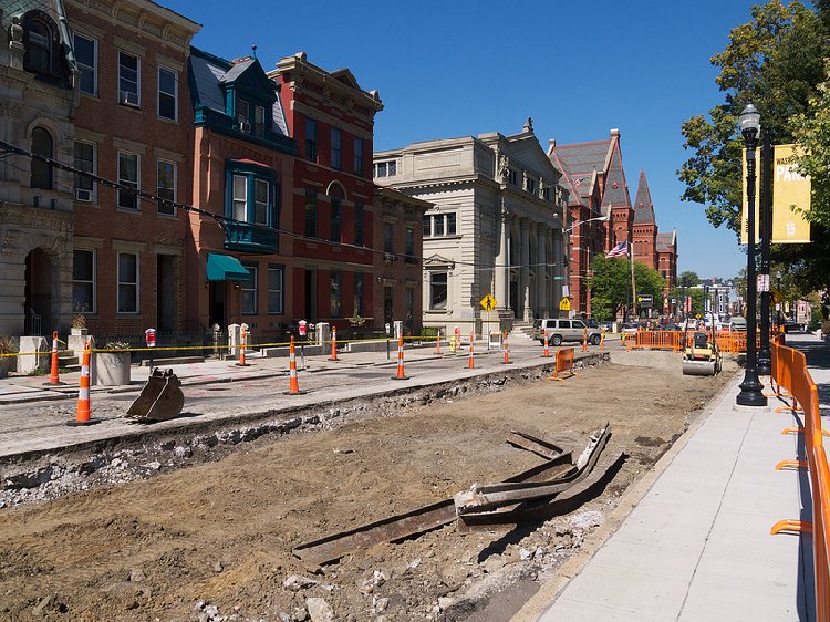
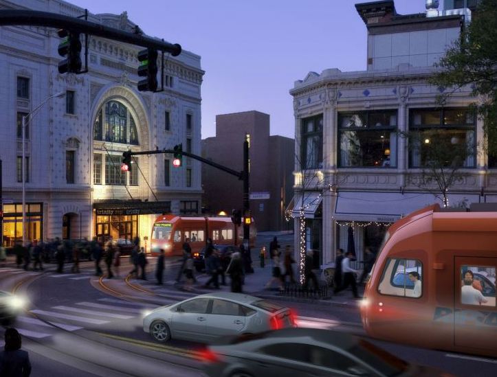
A long-awaited sight: streetcar construction on Cincinnati’s Elm Street. Photo: Travis Estell.
The key takeaway from Cincinnati is diversity of uses — connecting the two largest employment centers in the region with underpopulated historic districts between them, a large and growing public market, plus parks, schools, libraries, hotels and restaurants. When you put it all together, you have the likelihood of the streetcar’s near round-the-clock use almost every day of the week.
The Over-the-Rhine loop of the Cincinnati Streetcar will open for testing in mid-2015, the CBD loop about a year later.
Great things are happening in Cincinnati. Plan to visit soon.